


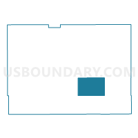
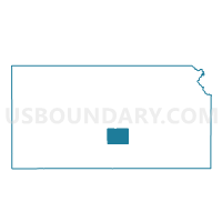
Castleton Township Voting District, Reno County, Kansas
About
Outline

Summary
| Unique Area Identifier | 586391 |
| Name | Castleton Township Voting District |
| County | Reno County |
| State | Kansas |
| Area (square miles) | 54.37 |
| Land Area (square miles) | 54.36 |
| Water Area (square miles) | 0.00 |
| % of Land Area | 99.99 |
| % of Water Area | 0.01 |
| Latitude of the Internal Point | 37.86328910 |
| Longtitude of the Internal Point | -97.95104830 |
Maps

Graphs
Select a template below for downloading or customizing gragh for Castleton Township Voting District, Reno County, Kansas


Neighbors
Neighoring Voting District (by Name) Neighboring Voting District on the Map
- Albion Township Voting District, Reno County, KS
- Center Township Voting District, Reno County, KS
- Haven Township Voting District, Reno County, KS
- Lincoln Township Voting District, Reno County, KS
- Ninnescah Township Voting District, Reno County, KS
- Roscoe Township Voting District, Reno County, KS
- Troy Township Voting District, Reno County, KS
- Yoder Township Voting District, Reno County, KS
Top 10 Neighboring County Subdivision (by Population) Neighboring County Subdivision on the Map
- Haven township, Reno County, KS (1,649)
- Albion township, Reno County, KS (841)
- Yoder township, Reno County, KS (798)
- Lincoln township, Reno County, KS (680)
- Center township, Reno County, KS (668)
- Castleton township, Reno County, KS (285)
- Ninnescah township, Reno County, KS (226)
- Troy township, Reno County, KS (124)
- Roscoe township, Reno County, KS (105)
Top 10 Neighboring Unified School District (by Population) Neighboring Unified School District on the Map
- Haven Public Schools Unified School District 312, KS (6,000)
- Pretty Prairie Unified School District 311, KS (1,602)